The Seawall
Stanley Park, Vancouver · Last verified Jun 2026
Around 28 km of paved, near-level waterfront path, with the 8.8 km Stanley Park loop as its signature stretch.
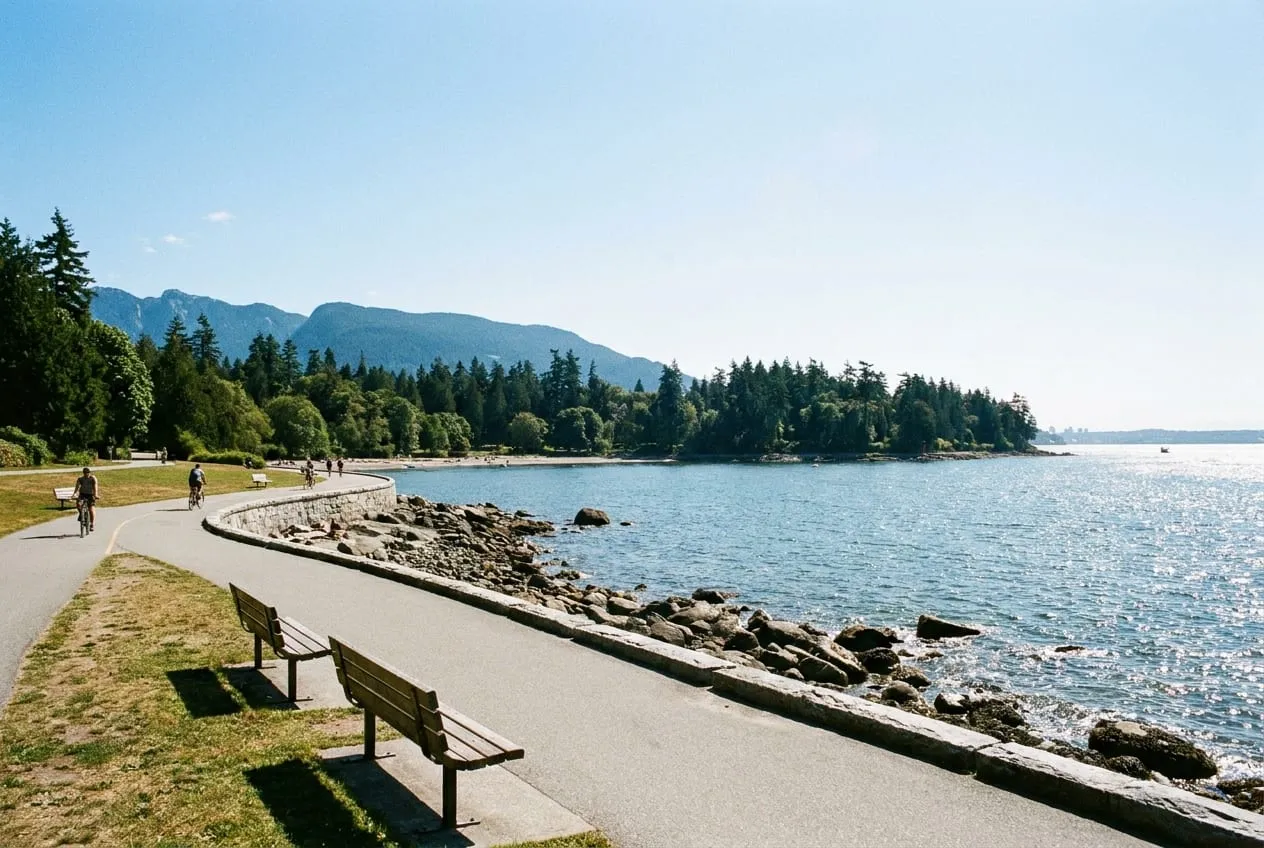
The seawall is the single best reason wheelchair users rate Vancouver as highly as they do. Continuous paved path runs roughly 28 km from Coal Harbour around Stanley Park, down both sides of False Creek and west to Spanish Banks, and it is almost entirely level. Gradients stay around 2 percent, the surface is smooth concrete or asphalt in consistent repair, and for most of the length the pedestrian side is physically separated from the cycle lane.
The Stanley Park section is the one to do first. Its 8.8 km loop hugs the water below the forest, passing the totem poles at Brockton Point, the Brockton Point lighthouse, Lions Gate Bridge and Third Beach, with the North Shore mountains across the inlet for much of the way. Travel is one-way counter-clockwise for wheels, which removes the head-on negotiation with cyclists that makes shared paths stressful elsewhere.
Facilities are spaced for the distance rather than clustered at the entrance. Accessible washrooms with grab bars and roughly 180 cm of turning space sit at several points around the loop, benches recur every few hundred metres, and blue-zone parking is available at multiple pull-offs so you can start and finish wherever your range allows rather than committing to the full circuit.
Two things to keep separate in your planning. The seawall is not the same as Stanley Park's interior, where forest trails are gravel, root-crossed and often muddy — an entirely different surface proposition. And the weather matters more than the terrain: with around 160 wet days a year, the concrete gets slick where it is polished by use, and exposed sections around Prospect Point catch wind straight off the inlet.
What the measurements mean
The main entrance is step-free. Accessible parking is available on site or immediately adjacent.
Internal routes are around 250 cm wide, so two wheelchairs can pass each other.
There is an accessible toilet. Grab bars are fitted. Turning space is about 180 cm, enough for a full turn in most wheelchairs.
Surfaces are smooth & even, which rolls easily. The steepest gradient is around 2%, gentle enough for most users.
The nearest step-free station is Stanley Park Loop on the 19 line, about 120 m away.
No specific sensory or communication support is documented for this place.
Assistance animals are welcome. Seating and rest points are available along the route.
What to expect
- The Stanley Park loop is 8.8 km of smooth concrete with a separated pedestrian side; travel is counter-clockwise.
- Accessible washrooms, benches and blue-zone parking recur at intervals around the loop.
- The 19 bus terminates at Stanley Park Loop about 120 m from the path; every TransLink bus is low-floor with a ramp.
Getting there step-free
Full accessibility profile
Every attribute below is recorded against the same protocol, so figures are comparable between places. Values are marked Measured or Estimate, and the sources are listed above.Entrance & arrival
Accessible restroom
Surfaces & slopes
Getting there
Sensory & communication
Policies & assistance
Practical tips
- Several nearby beaches have firm accessible matting and beach wheelchairs in summer; the city publishes which ones.
- Waterfront SkyTrain station is accessible and about 1.4 km from the Coal Harbour end of the path.
- There is no staffed information point on the path itself — plan your water, shade and washroom stops beforehand.
The Seawall: common accessibility questions
Is the Vancouver seawall wheelchair accessible?
Yes, and unusually so. Around 28 km of paved path runs from Coal Harbour through Stanley Park and False Creek to Spanish Banks at gradients near 2 percent, with the pedestrian side separated from cyclists for most of its length. Accessible washrooms, benches and blue-zone parking recur at intervals.
How long is the accessible Stanley Park seawall loop?
8.8 km, on smooth concrete at the water's edge, passing the totem poles, Brockton Point lighthouse, Lions Gate Bridge and Third Beach. Wheeled travel is counter-clockwise. Blue-zone parking at several points lets you start and finish partway rather than committing to the whole loop.
Are Stanley Park's forest trails accessible too?
No, and they should be treated as a separate decision from the seawall. The interior trails are gravel and packed earth, crossed by roots, and often muddy after rain. The seawall is paved and level; the forest network is not.